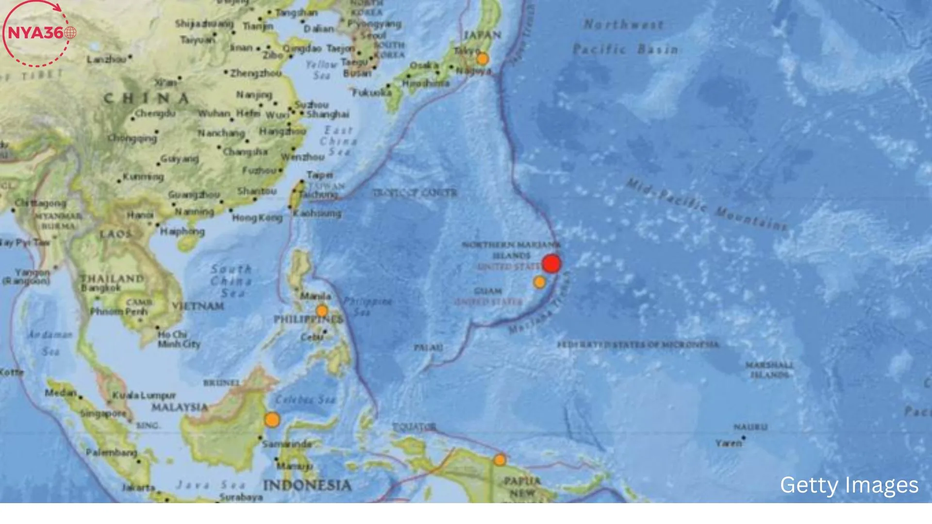
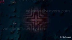
A 6.3-magnitude earthquake struck the Northern Mariana Islands early Monday, disturbing the U.S. territory in the Pacific Ocean. The United States Geological Survey (USGS) verified that the quake occurred at a depth of 42.9 kilometers (26.6 miles), with its epicenter situated at 262 kilometers (163 miles) northeast of Saipan, the largest of the Northern Mariana Islands. Notwithstanding the intensity of the tremor, no tsunami alert was disseminated, and there were no prompt reports of substantial damage or fatalities.
The earthquake, which transpired at approximately 5:00 a.m. local time, generated shockwaves throughout the region but was sufficiently distant from the coast to avert extensive damage on the inhabited islands. Inhabitants of Saipan and adjacent islands, such as Tinian and Rota, reported experiencing the tremor, although the intensity of shaking differed based on proximity to the epicenter. Seismologists classed the earthquake as a moderate-to-strong seismic event, noting that its depth mitigated the surface impact.
The Mariana Islands, positioned in the western Pacific, are a component of the broader Mariana Archipelago, located inside a seismically active area referred to as the “Ring of Fire.” This region is susceptible to recurrent earthquakes and volcanic activity resulting from tectonic movements between the Pacific Plate and the Philippine Sea Plate, which converge and collide beneath the oceanic crust.
Currently, no substantial structural damage or fatalities have been reported in Saipan, Tinian, or adjacent islands, however, local authorities continue to evaluate the situation. Structures in the region are engineered to endure seismic events, which are prevalent in the area. Residents promptly reacted by implementing precautionary measures and seeking refuge in open areas as the tremors subsided.
No tsunami warning was issued; nonetheless, the potential for aftershocks persists. The Pacific Tsunami Warning Center (PTWC) diligently observed the circumstances in the hours after the earthquake, verifying that there was no imminent tsunami hazard. The PTWC warned residents to exercise caution and remain informed about expected aftershocks in the forthcoming days. Local authorities in the Northern Mariana Islands mobilized emergency response teams to guarantee the functionality of all essential infrastructure, including hospitals, electricity facilities, and water supply systems. Governor Arnold Palacios told the people that the government was implementing all requisite measures to oversee the situation and address any emerging requirements.
Governor Palacios stated, “We are grateful that no tsunami warning has been issued, and preliminary reports suggest no significant damage.” “Our emergency services are on heightened alert, and we urge residents to remain informed and prepare for potential aftershocks.” The Northern Mariana Islands are situated in a highly tectonically active region of the Earth. The archipelago is located at the juncture of the Pacific Plate and the Philippine Sea Plate, where the two plates are perpetually in motion. This tectonic activity accounts for the recurrent earthquakes and volcanic eruptions in the area.
The Mariana Trench, the world’s deepest oceanic trench, is situated east of the islands and is formed by subduction, a geological process in which one tectonic plate descends beneath another. This mechanism produces substantial seismic energy and is the principal cause of the region’s recurrent earthquakes. The trench is positioned to the east, while the earthquake’s epicenter was located to the northeast of Saipan, in a region characterized by analogous tectonic activities. The Northern Mariana Islands experience frequent earthquakes due to the region’s geological configuration, however, the intensity and occurrence of these seismic events may differ. The region hosts multiple active volcanoes, such as Mount Pagan and Mount Agrigan, which have seen eruptions in recent history.
In the Northern Mariana Islands, earthquakes pose a constant threat, prompting local authorities to emphasize seismic preparedness to reduce potential damage and casualties. The islands’ infrastructure, comprising public edifices and individual dwellings, is built with earthquake-resistant materials to comply with seismic building regulations. Moreover, educational institutions, enterprises, and community organizations consistently engage in earthquake drills to guarantee that inhabitants are prepared to respond when seismic activity occurs.

Public education initiatives in the Northern Mariana Islands emphasize instructing citizens on the “Drop, Cover and Hold On” technique, which is the advised safety protocol during an earthquake. Residents are urged to maintain emergency supplies, including food, water, flashlights, and first aid kits, readily accessible for potential protracted outages or aftershocks. Although the earthquake did not result in significant disruption this time, the area’s historical seismic activity has rendered residents watchful. In 2018, a 7.7-magnitude earthquake occurred in the Mariana Islands, prompting a tsunami warning that was subsequently rescinded. Although a significant tsunami did not transpire, the incident highlighted the possible hazards associated with seismic activity in the region.
Seismologists and geologists persist in observing the Pacific region for indications of forthcoming seismic activity. The USGS and many international organizations meticulously analyze the Ring of Fire tectonic processes, employing sophisticated technologies to monitor plate movements, fault lines, and seismic occurrences. These initiatives seek to enhance early warning systems and augment the precision of earthquake predictions while forecasting an earthquake’s precise timing and position continues to be difficult.
The Pacific Tsunami Warning Center is essential for monitoring seismic activities in the area and issuing real-time notifications for potential tsunamis. Their early detection systems safeguard coastal communities throughout the Pacific, encompassing island nations such as the Northern Mariana Islands and the western shores of the United States and Canada. The 6.3-magnitude earthquake near the Northern Mariana Islands on Monday highlights the seismic hazards confronting Pacific communities. Although no tsunami warning was given and no significant damage was reported, the incident highlights the necessity for ongoing monitoring, preparedness, and investment in earthquake-resistant infrastructure in the area.
As the situation evolves and authorities evaluate potential aftershocks, the people of Saipan and adjacent islands are urged to remain informed and adhere to safety practices to safeguard their well-being. The earthquake underscores the essential function of international monitoring organizations such as the USGS and PTWC in ensuring public awareness and safety during natural catastrophes.
Follow us on social media: Instagram, Threads & Twitter X @nya360_ YouTube & Facebook @nya360.